

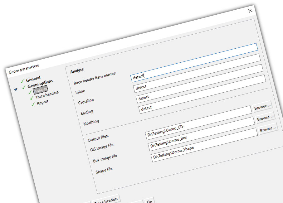
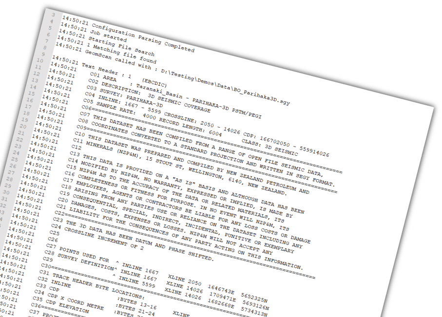
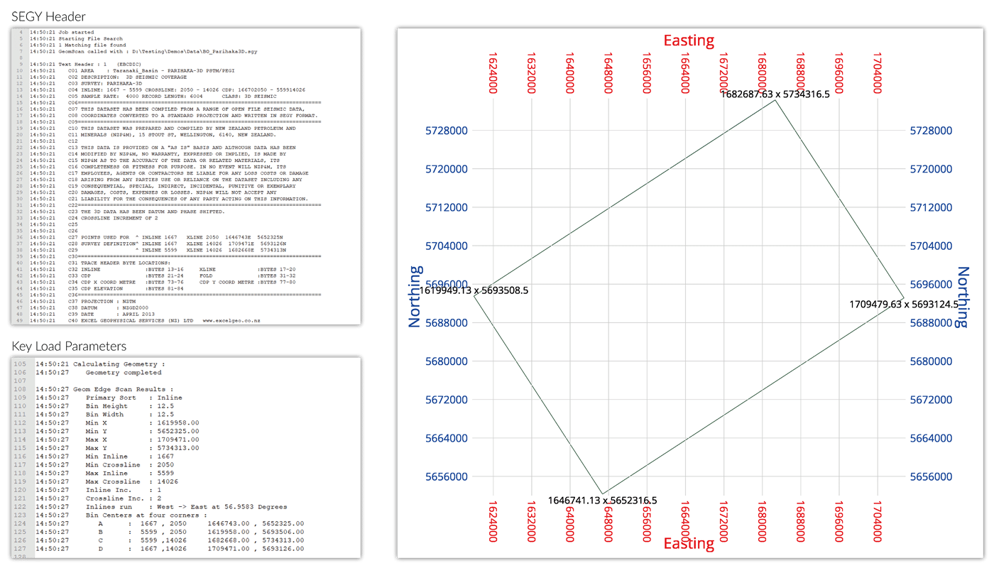
Within a few seconds this utility reports key parameters including spacing and extents of inlines, crosslines and x/y coordinates for a 3D dataset as a geometrical quality control check prior to lengthy data loading operations.
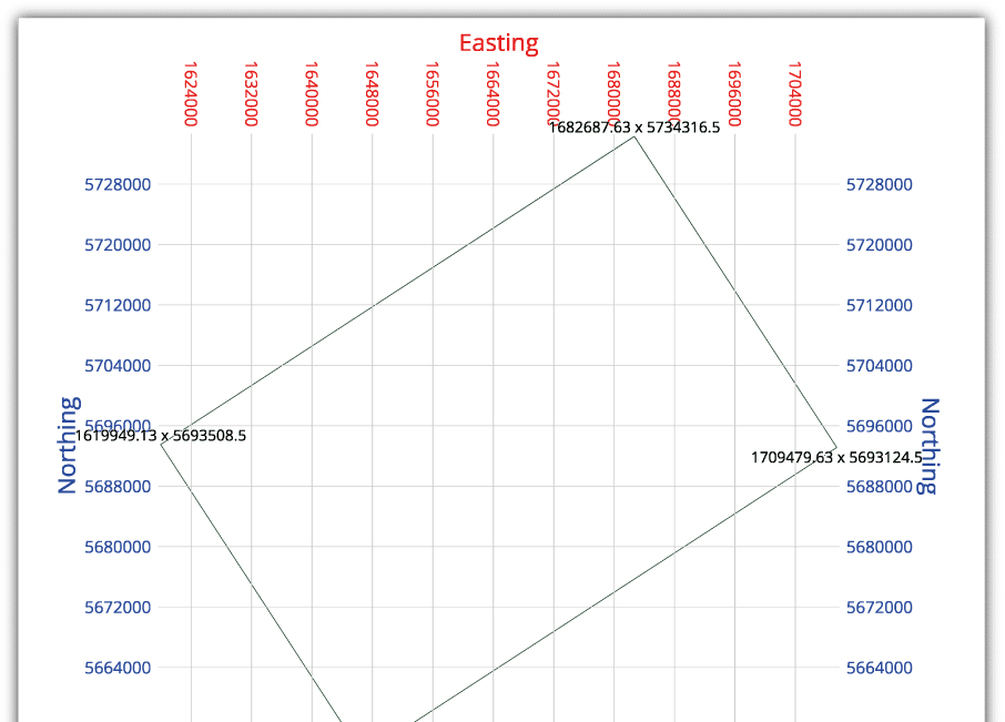
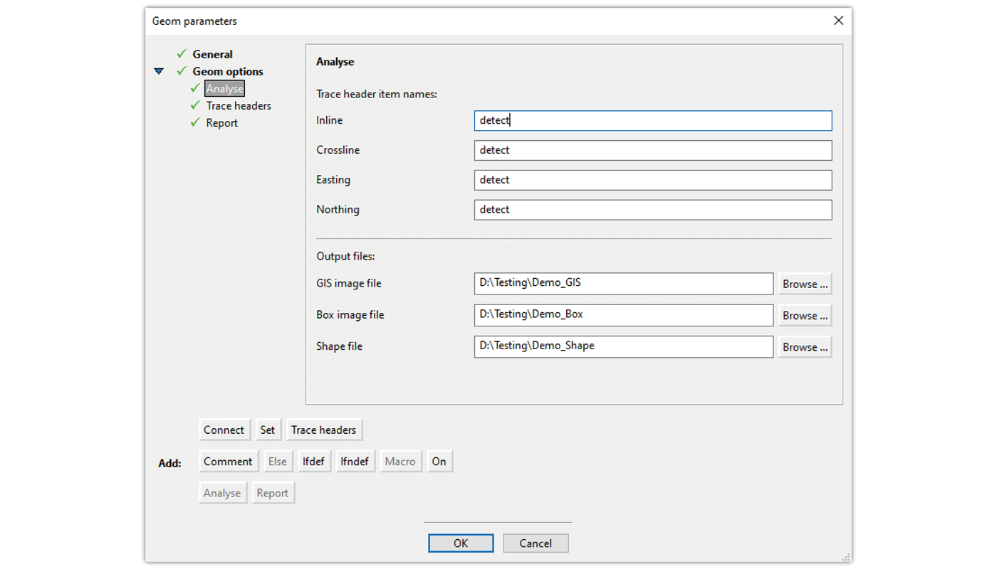
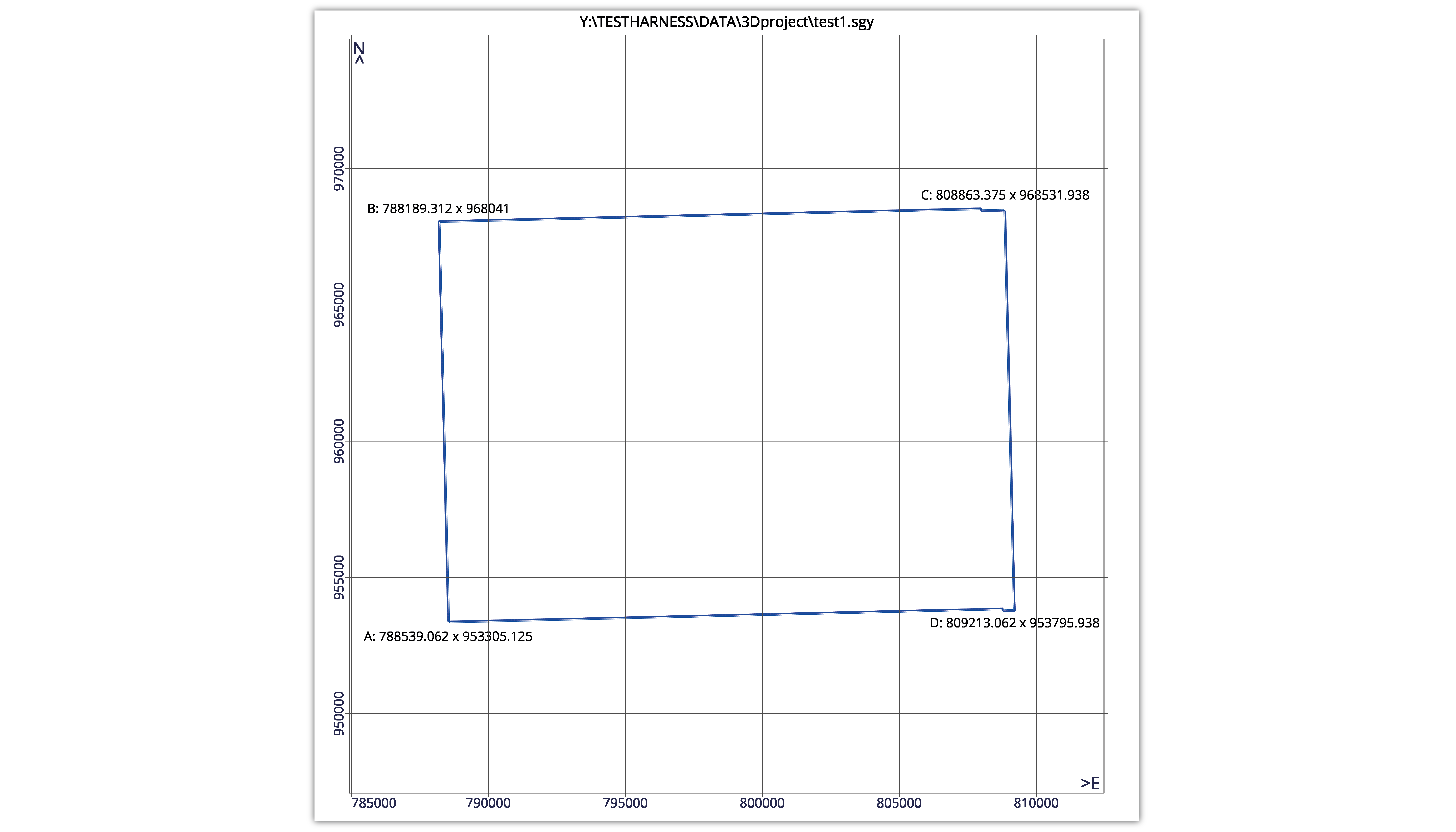
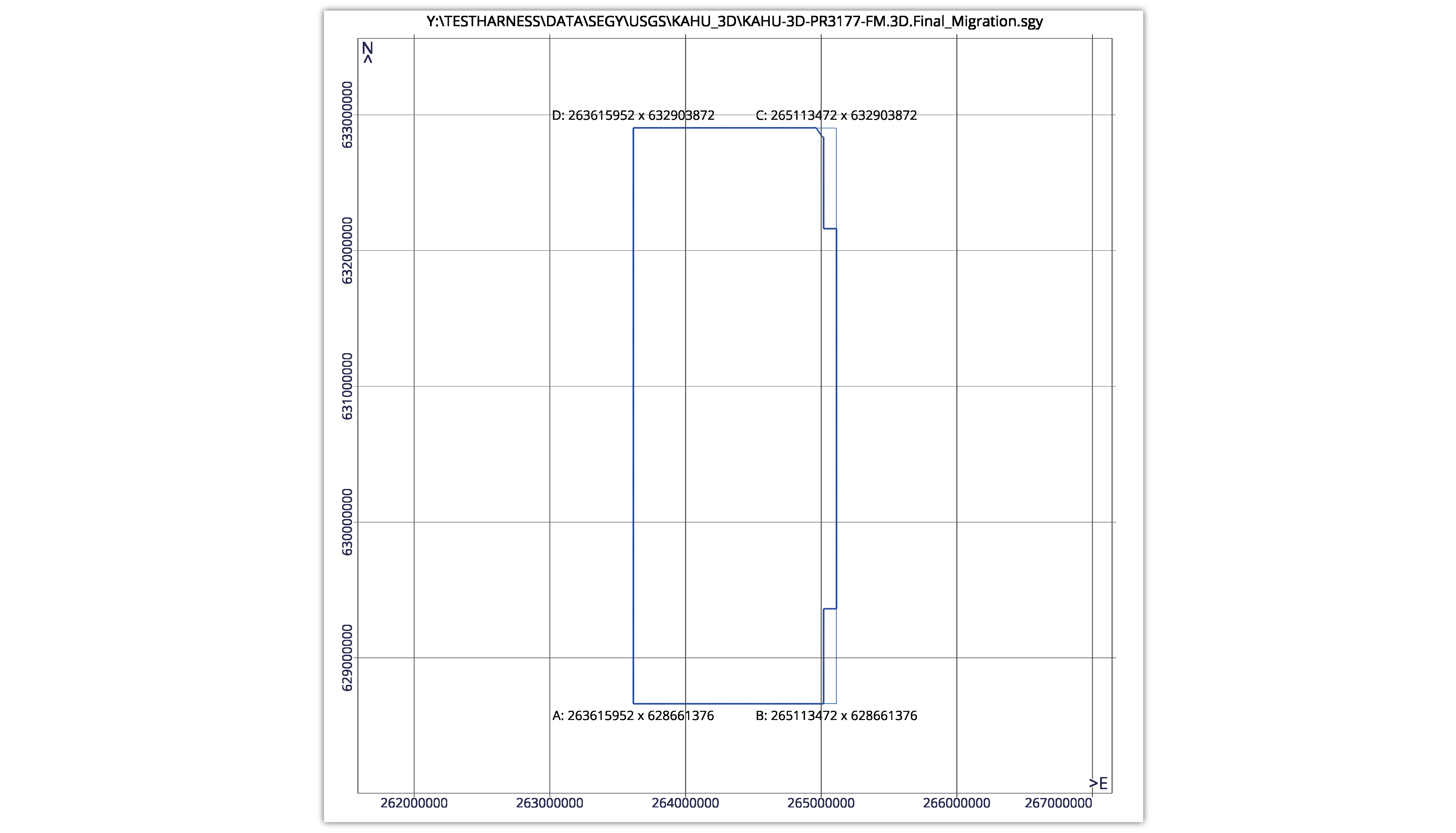
Geom will calculate and output inline/crossline corner points, survey azimuth, bin dimensions, trace count, etc. and can produce an outline surface type image. Geom can be used to validate and gain assurance that your data meets your basic requirements. Geom is a high-speed post-stack SEG-Y 3D data geometry analysis tool which allows the user to collect information on:
- Textual headers
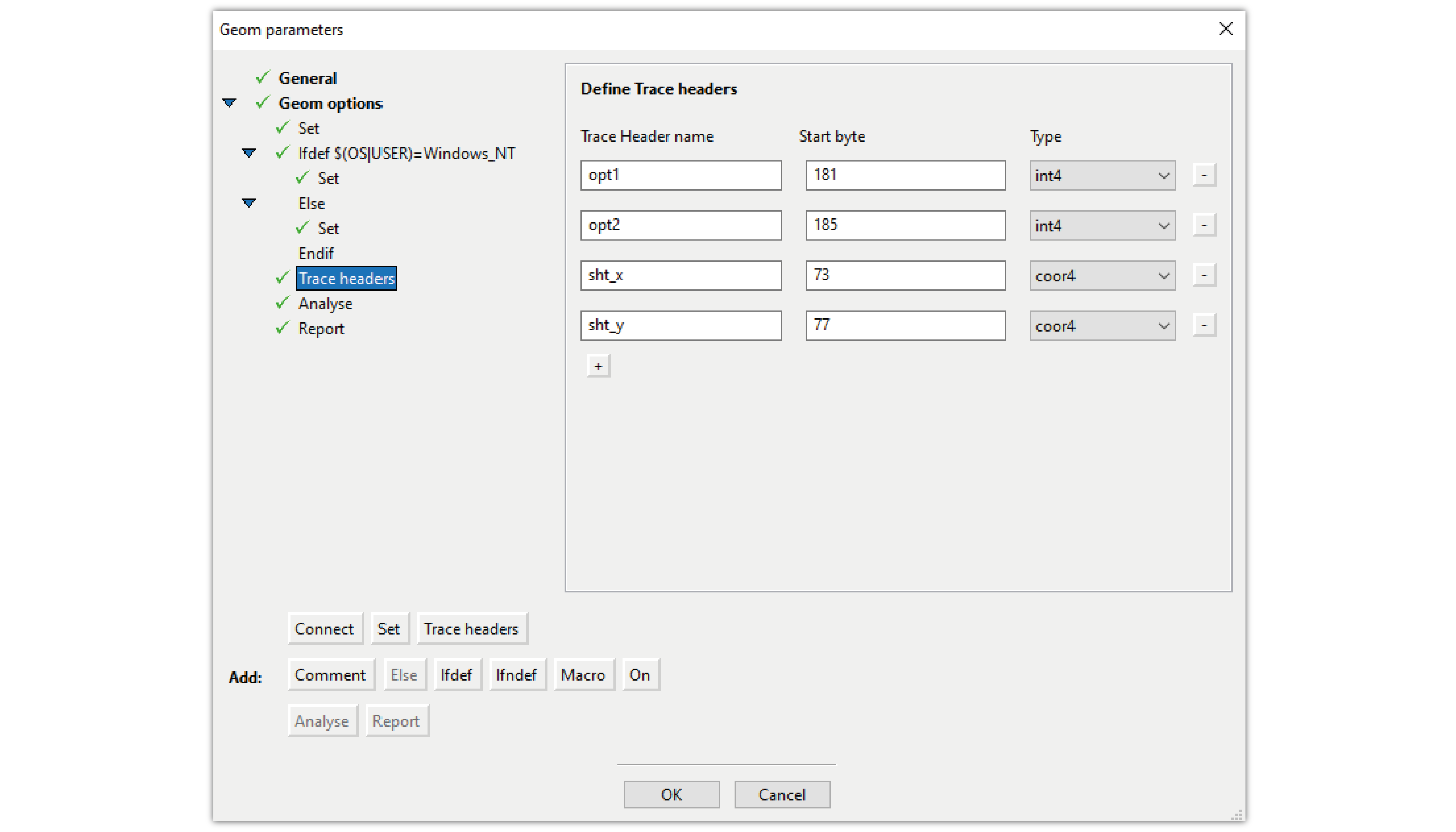
- Trace headers
- Bin Spacing
- Inline/crossline and x/y coordinates
- Geometrical corner points
- Shapefiles
- Logfile
136GB analysed in less than 12 seconds

Troika's understanding of seismic data is second to none
The Troika team has been involved with the SEG Technical Standards Committee since 1999. Members including Bob Firth, Jill Lewis and Victor Ancira have been driving the development, review and ratification processes of modern industry standards such as SEG-Y 1, SEG-Y 2, SEG-D 2.1, SEG-D 3 and SEG-D 3.1. The result is we understand seismic data recording formats better than any other company.
Read More